| data fields | Note |
|---|---|
| number | 001 |
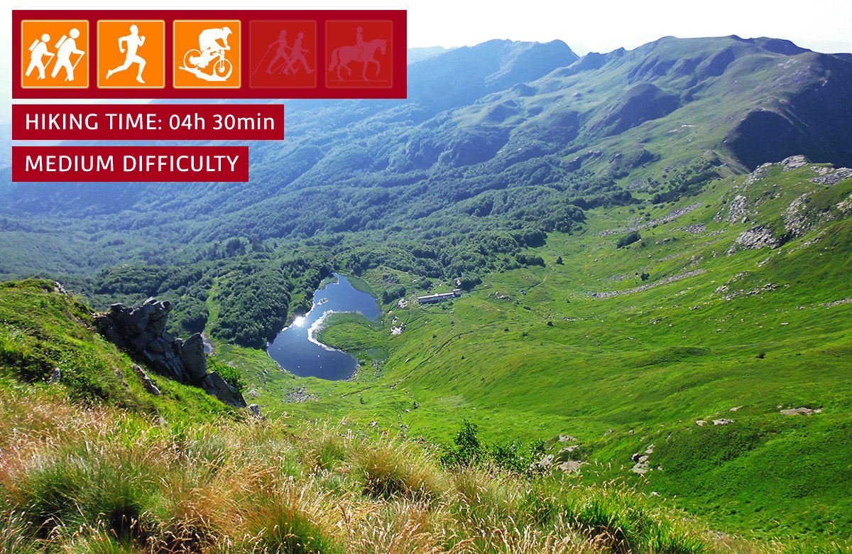
| suitable for |
|
| degree of difficulty |
|
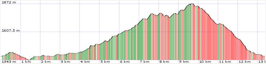
| distance | 14 km |
| difference in altitude | 800 mt D+ e 800 mt D- |
| hiking time | 4h 30' |
| recommended period |
|
| Road surface | dirt road, path, rocky ground |
Trail 1 - Lago Nero
Discovering the beauties of Lago Nero
An excursion of great impact that will allow you to reach one of the most characteristic places of the Pistoia Apennines. The first part of the route (up to Lago Nero) is perfectly suited to outings for the whole family. In winter, when the snow whitens the peaks of Abetone, this first stretch is used for wonderful snowshoeing.
